Thursday, 18 May 2017

kedarnath

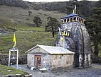
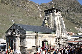
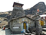
Kēdārnāth Mandir (Kedarnath Temple) is a Hindu temple dedicated to Lord Shiva. It is on the Garhwal Himalayan range near the Mandakini river in KedarnathUttarakhand in India. Due to extreme weather conditions, the temple is open only between the end of April (Akshaya Tritriya) to Kartik Purnima (the autumn full moon, usually November). During the winters, the vigrahas (deities) from Kedarnath temple are brought to Ukhimath and worshiped there for six months. Lord Shiva is worshiped as Kedarnath, the 'Lord of Kedar Khand', the historical name of the region.[1]
The unstable temple is not directly accessible by road and has to be reached by a 14 kilometres (8.7 mi) uphill trek from Gaurikund. Pony and manchan service is available to reach the structure. The temple was built by Pandavas and revived by Adi Sankaracharya and is one of the twelve Jyotirlingas, the holiest Hindu shrines of Shiva. It is one of the 275 Paadal Petra Sthalams, expounded in Tevaram. Pandavas were supposed to have pleased Shiva by doing penance in Kedarnath. The temple is one of the four major sites in India's Chota Char Dham pilgrimage of Northern Himalayas. This temple is the highest among the 12 Jyotirlingas.[2] Kedarnath was the worst affected area during the 2013 flash floods in North India. The temple complex, surrounding areas and Kedarnath town suffered extensive damage, but the temple structure did not suffer any "major" damage, apart from a few cracks on one side of the four walls which was caused by the flowing debris from the higher mountains. A large rock among the debris acted as a barrier, protecting the temple from the flood. The surrounding premises and other buildings in market area were heavily damaged.

Temple and past significance

The temple, at an height of 3,583 m (11,755 ft), 223 km from Rishikesh, on the shores of Mandakini river, a tributary of Ganga, is an impressive stone edifice of unknown date.[5] The structure is believed to have been constructed in the 8th century CE, when Adi Shankara visited. The present structure is on a site adjacent to where Pandavas are believed to have built the temple. It has one Garbhagriha and a Mandapa, and stands on a plateau surrounded by snow clad mountain and glaciers. In front of the temple, directly opposite to the inner shrine, is a Nandi statue carved out of rock.

Ancient History

According to History, during the Mahabharatha War, the Pandavas killed their relatives; to absolve themselves of this sin, the Pandavas undertook a pilgrimage. But Lord Vishweshwara was away in Kailasa in the Himalayas. On learning this, the Pandavas left Kashi. They reached the Himalayas via Haridwar. They saw Lord Shankara from a distance. But Lord Shankara hid from them. Then Dharmaraj said: "Oh, Lord, You have hidden yourself from our sight because we have sinned. But, we will seek You out somehow. Only after we take your Darshan would our sins be washed away. This place, where You have hidden Yourself will be known as Guptakashi and become a famous shrine."
From Guptakashi (Rudraprayag), the Pandavas went ahead till they reached Gaurikund in the Himalayas valleys. They wandered there in search of Lord Shankara. While doing so Nakul and Sahadev found a buffalo which was unique to look at.
Then Bheema went after the buffalo with his mace. The buffalo was clever and Bheema could not catch him. But Bheema managed to hit the buffalo with his mace. The buffalo had its face hidden in a crevice-in the earth. Bheema started to pull it by its tail. In this tug-of war, the face of the buffalo went straight to Nepal, leaving its hind part in Kedar. The face is Doleshwar Mahadev in SipadolBhaktapur, Nepal.[6][7][8]
On this hind part of Mahesha, a JyotirLinga appeared and Lord Shankara appeared from this light. By getting a Darshan of Lord Shankar, the pandavas were absolved of their sins. The Lord told the Pandavas, "From now on, I will remain here as a triangular shaped JyotirLinga. By taking a Darshan of Kedarnath, devotees would attain piety". A triangular shaped rock is worshiped in Garbhagriha of the temple. Surrounding Kedarnath, there are many symbols of the Pandavas. Raja Pandu died at Pandukeshwar. The tribals here perform a dance called "Pandav Nritya". [9] The mountain top where the Pandavas went to Swarga, is known as "Swargarohini", which is located off Badrinath. When Darmaraja was leaving for Swarga, one of his fingers fell on the earth. At that place, Dharmaraj installed a Shiva Linga, which is the size of the thumb. To gain Mashisharupa, Shankara and Bheema fought with maces. Bheema was struck with remorse. He started to massage Lord Shankara’s body with ghee. In memory of this event, even today, this triangular Shiva JyotirLinga is massaged with ghee. Water and Bel leaves are used for worship.
When Nara-Narayan went to Badrika village and started the worship of Parthiva, Shiva appeared before them. Nara-Narayan wished that, for the welfare of the humanity, Shiva should remain there in his original form. Granting their wish, in the snow-clad Himalayas, in a place called Kedar, Mahesha himself stayed there as a Jyoti. Here, He is known as Kedareshwara.

Inside temple

The presiding image of Kedaranth in the form of lingam is or irregular shape with an pedestal 3.6 m (12 ft) in circumference and 3.6 m (12 ft) in height. There is a small pillared hall in front of the temple, that has images of Parvathi and of the five Pandava princes. There are five teamples around namely Badari-kear, Madhya Maheswara, Tunganatha, Rudranatha and Kallesvara.[10] The first hall inside Kedarnath Temple contains statues of the five Pandava brothers, Lord KrishnaNandi, the vehicle of Shiva and Virabhadra, one of the guards of Shiva. Statue of Draupadi and other deities are also installed in the main hall. [1] An unusual feature of the temple is the head of a man carved in the triangular stone fascia. Such a head is seen carved in another temple nearby constructed on the site where the marriage of Shiva and Parvati was held. Adi Shankara was believed to have revived this temple, along with Badrinath and other temples of Uttarakhand; he is believed to have attained Mahasamadhi at Kedaranath. Behind the temple is the samādhi mandir of Adi Sankara.[11]
The head priest (Raval) of the Kedarnath temple belongs to the Veerashaiva community from Karnataka.[12] However, unlike in Badrinath temple, the Raval of Kedarnath temple does not perform the pujas. The pujas are carried out by Raval's assistants on his instructions. The Raval moves with the deity to Ukhimath during the winter season. There are five main priests for the temple, and they become head priests for one year by rotation. The present (2013) Raval of Kedarnath temple is Shri Vageesha Lingacharya.[12] Shri Vageesh Ligaacharya who belongs from the Village Banuvalli of Taluka Harihar of Davanagere district in Karnataka. During Pooja of Lord Shiva at Kedaranath the mantras will be pronounced in the Kannada language. This has been a custom from hundreds of years.[13]

Administration

The temple was included in the Uttar Pradesh state government Act No. 30/1948 as Act no. 16,1939, which came to be known as Shri Badarinath and Shri Kedarnath Mandir Act. The committee nominated by the state government administers both temples. The act was modified in 2002, which provisioned adding additional committee members including Government officials and a Vice chairman.[14] There are a total of seventeen members in the board; three selected by the Uttaranchal Legislative Assembly, one member each by the Zilla Parishads of Garhwa, Tehri, Chamoli and Uttarkashi, and ten members nominated by the state government.[15] On the religious side, there is a Rawalji (chief priest) and three other priests: Nayab Rawal, Acharya/Dharmadhikari and Vedpathi.[16] The administrative structure of the temple consists of a chief executive officer who executes the orders from the state government. A deputy chief executive officer, two OSDs, an executive officer, an account officer, a temple officer and a publicity officer assist the chief executive officer.[17]

2013 flash floods

Main article: 2013 North India floods
The Kedarnath valley, along with other parts of the state of Uttarakhand, was hit with unprecedented flash floods on 16 and 17 June, 2013. On 16 June, at about 7:30 p.m. a landslide and mudslides occurred near Kedarnath Temple with loud peals of thunder. An enormously loud peal was heard and huge amounts of water started gushing from Chorabari Tal or Gandhi Tal down Mandakini river at about 8:30 p.m. washing everything away in its path. On 17 June 2013 at about 6:40 a.m. in the morning waters again started cascading at a huge speed from river Swaraswati and Chorabari Tal or Gandhi Tal bringing along with its flow huge amount of silt, rocks and boulders. A huge rock got stuck behind Kedarnath Temple and protected it from the ravages of the flood. The waters gushed on both the sides of the temple destroying everything in their path. Even eyewitness observed that one large rock got carried to the rear side of Kedarnath Temple, thus causing obstruction to the debris, diverting the flow of river and debris to the sides of the temple avoiding damage.
Another theory for the temple not being destroyed is because of its construction.[18][19][20][21] Although the temple withstood the severity of the floods, the complex and surrounding area were destroyed, resulting in the death of hundreds of pilgrims and locals. Shops and hotels in Kedarnath were destroyed and all roads were broken. People took shelter inside the temple for several hours, until Indian army airlifted them to safer places.[12] The Uttarakhand Chief Minister announced that the Kedarnath shrine would remain closed for a year for clearing the debris.
The experts, who were asked by the Archaeological Survey of India (ASI) to examine the condition of the foundation in wake of the floods have arrived at the conclusion that there was no danger to the temple.The IIT Madras experts visited the temple thrice for the purpose. Non-destructive testing instruments that do not disturb the structure of the temple were used by the IIT-team for assessing the health of the structure, foundation and walls. They have submitted their interim report that the temple is stable and there was no major danger.[22][23][24]
GANGOTRI

Gangotri (Hindiगंगोत्री) is a town and a Nagar Panchayat (municipality) in Uttarkashi district in the state of Uttarakhand, India. It is a Hindu pilgrim town on the banks of the river Bhagirathi and origin of River Ganges. It is on the Greater Himalayan Range, at a height of 3,100 metres (10,200 ft). According to popular Hindu legend, it was here that Goddess Ganga descended when Lord Shiva released the mighty river from the locks of his hair.

Geography

Gangotri is located at 30.98°N 78.93°E.[1]

Gangotri Temple

Gangotri, the origin of the River Ganges and seat of the goddess Ganga, is one of the four sites in the Chota Char Dham pilgrimage circuit. The original Gangotri Temple was built by the Gurkha general Amar Singh Thapa. The river is called Bhagirathi at the source and acquires the name Ganga (the Ganges) from Devprayag onwards where it meets the Alaknanda. The origin of the holy river is at Gaumukh, set in the Gangotri Glacier, and is a 19 km trek from Gangotri.
Places to visit near the Gangotri Temple
  • Bhagirath Shila is believed to be the holy rock where King Bhagirath prayed to Lord Shiva.
  • Pandava Gufa, located 1.5 km from Gangotri, is the place where the Pandavas are believed to have meditated and rested en route Kailash. Pilgrims will have to trek up to the Pandava Gufa.
In the pilgrimage journey of Chota Char Dham, Gangotri is often visited after Yamunotri (located on the western region of Garhwal Hills). Pilgrims generally make Uttarkashi as their base camp. The time taken from Uttarkashi to Gangotri temple is about 4 hours by road.

Historical relation

According to Hindu history, Goddess Ganga took the form of a river to absolve the sins of King Bhagiratha's predecessors, following his severe penance of several centuries.

Submerged Shivlingam

According to this legend, King Sagara, after slaying the demons on earth decided to stage an Ashwamedha Yajna as a proclamation of his supremacy. The horse which was to be taken on an uninterrupted journey around the earth was to be accompanied by the King's 60,000 sons born to Queen Sumati and one son Asamanja born of the second queen Kesani. Indra, supreme ruler of the gods feared that he might be deprived of his celestial throne if the "Yajna" (worship with fire) succeeded and then took away the horse and tied it to the ashram of Sage Kapil, who was then in deep meditation. The sons of the King Sagara searched for the horse and finally found it tied near the meditating sage. Sixty thousand angry sons of King Sagara stormed the ashram of sage Kapil. When he opened his eyes, the 60,000 sons had all perished, by the curse of sage Kapil. Bhagiratha, the grandson of King Sagar, is believed to have meditated to please the Goddess Ganga enough to cleanse the ashes of his ancestors, and liberate their souls, granting them salvation or Moksha.

Demographics

As of 2001 India census,[2] Gangotri had a population of 606. Males constitute 60% of the population and females 40%. Gangotri has an average literacy rate of 89%, male literacy is 91%, female literacy is 80%. In Gangotri, average age of the population is under 6 years of age.

badrinath temple

Badrinath is a holy town and a nagar panchayat in Chamoli district in the state of UttarakhandIndia. It is the most important of the four sites in India's Char Dham pilgrimage and gets its name from the temple of Badrinath.

Name

Badri refers to a berry that was said to grow abundantly in the area, and nath means "Lord of". Badri is also the Sanskrit name for the Indian Jujube tree,[1] which has an edible berry. Some scriptural references refer to Jujube trees being abundant in Badrinath.

History

Badrinath was reëstablished as a major pilgrimage site by Adi Shankara in the 7th century.[2] In earlier days, pilgrims used to walk hundreds of miles to visit Badrinath temple.[3]
The temple has been repeatedly destroyed by earthquakes and avalanches. As late as the First World War, the town consisted only of the 20-odd huts used by the temple's staff, but the site drew thousands each year and up to 50,000 on its duodecennial festivals.[4] In recent years its popularity has increased still more, with an estimated 600,000 pilgrims visiting during the 2006 season,[5] compared to 90,676 in 1961.[6] The temple in Badrinath is also a sacred pilgrimage site for Vaishnavites. Badrinath is also gateway to several mountaineering expeditions headed to mountains like Nilkantha.[3]

Temple

Badrinath is one of the most popular and religious holy towns of the Hindus located at Chamoli district of Uttarakhand in India.
Badrinath temple in night after closing ceremony.
Neelkanth Parbat from Badrinath
View from Badrinath
Badrinath Town
Badrinath Temple surroundings
Sheeshtaal (Sheshnaag lake)
The Badrinath temple is the main attraction in the town. According to legend Shankar discovered a black stone image of Lord Badrinarayan made of Saligram stone in the Alaknanda River. He originally enshrined it in a cave near the Tapt Kund hot springs.[6][7] In the sixteenth century, the King of Garhwal moved the murti to the present temple.[6] The temple is approximately 50 ft (15 m) tall with a small cupola on top, covered with a gold gilt roof.[6] The facade is built of stone, with arched windows. A broad stairway leads up to a tall arched gateway, which is the main entrance. The architecture resembles a Buddhist vihara (temple), with the brightly painted facade also more typical of Buddhist temples.[8] Just inside is the mandapa, a large pillared hall that leads to the garbha grha, or main shrine area. The walls and pillars of the mandapa are covered with intricate carvings.[8]

Legend

According to the Bhagavata Purana, "There in Badrikashram the supreme being (Vishnu), in his incarnation as the sages Nara and Narayana, had been undergoing great penance since time immemorial for the welfare of all living entities." (Bhagavata Purana 3.4.22)
The Badrinath area is referred to as Badari or Badarikaashram (बदरिकाश्रम) in Hindu scriptures. It is a place sacred to Vishnu, particularly in Vishnu's dual form of Nara-Narayana. Thus, in the Mahabharata, Krishna, addressing Arjuna, says, "Thou wast Nara in a former body, and, with Narayana for thy companion, didst perform dreadful austerity at Badari for many myriads of years."[9][10]
One legend has it that when the goddess Ganga was requested to descend to earth to help suffering humanity on the request of suryavansh king bhagiratha, the earth was unable to withstand the force of her descent. Therefore, the mighty Ganga (Ganges) was split into two holy channels, with Alaknanda one of them.
Another Legend explains both name and sitting posture as this place was full of Badri bushes and Vishnu meditating for, beloved Lakshmi stood next to him sheltering him from scorching sunlight turned into a Badri herself called 'BADRI VISHAL' and her lord(Nath) became the BadriNath.
The mountains around Badrinath are mentioned in the Mahabharata, when the Pandavas were said to have expired one by one, when ascending the slopes of a peak in western Garhwal called Swargarohini.(literal meaning - the 'Ascent to Heaven'). The Pandavas passed through Badrinath and the town of Mana, 4 km north of Badrinath, on their way to Svarga (heaven). There is also a cave in Mana where Vyasa, according to legend, wrote the Mahabharata.[6]
The area around Badrinath was celebrated in Padma Purana as abounding in spiritual treasures.[6]

Geography

Badrinath has an average elevation of 3,100 metres (10,170 feet). It is in the Garhwal Himalayas, on the banks of the Alaknanda River. The town lies between the Nar and Narayana mountain ranges 9 km east of Nilkantha peak (6,596m). Badrinath is located 62 km northwest of Nanda Devi peak and 301 km north of Rishikesh. From Gaurikund (near Kedarnath) to Badrinath by road is 233 km.

Demographics[edit]

As of 2001 India census,[11] Badrinath had a population of 841. Males constitute 55% of the population and females 45%. Badrinath has an average literacy rate of 89%, ; with 92% of the males and 86% of females literate. 9% of the population is under 6 years of age.

first view of uttarakhand

Uttarakhand (Listeni/ˌʊtəˈrɑːkʌnd/),[4] officially the State of Uttarakhand (Hindiउत्तराखण्ड राज्यIASTUttarākhaṇḍ Rājya), formerly known as Uttaranchal,[5]is a state in the northern part of India. It is often referred to as the Devbhumi[citation needed] (literally "Land of the Gods") due to many Hindutemples and pilgrimage centres found throughout the state. Uttarakhand is known for its natural beauty of the Himalayas, the Bhabhar and the Terai. On 9 November 2000, Uttarakhand became the 27th state of the Republic of India, being created from the Himalayan and adjoining northwestern districts of Uttar Pradesh.[6] It borders Tibet to the north; the Mahakali Zone of the Far-Western RegionNepal to the east; and the Indian states of Uttar Pradesh to the south and Himachal Pradesh to the west and north-west as well as Haryana on its south-western corner. The state is divided into two divisions, Garhwal and Kumaon, with a total of 13 districts. The interim capital of Uttarakhand is Dehradun, the largest city in the region, which is a railhead. The High Court of the state is in Nainital.
Archaeological evidence supports the existence of humans in the region since prehistoric times. The region formed a part of the Kuru and the Panchal kingdoms (mahajanpads) during the Vedic age of Ancient India. Among the first major dynasties of Kumaon were the Kunindas in the 2nd century BCE who practised an early form of ShaivismAshokan edicts at Kalsi show the early presence of Buddhism in this region. During the medieval period, the region was consolidated under the Kumaon Kingdom and Garhwal Kingdom. In 1816, most of modern Uttarakhand was ceded to the British as part of the Treaty of Sugauli. Although the erstwhile hill kingdoms of Garhwal and Kumaon were traditional rivals, the proximity of different neighboring ethnic groups and the inseparable and complementary nature of their geography, economy, culture, language, and traditions created strong bonds between the two regions which further strengthened during the Uttarakhand movement for statehood in the 1990s.
The natives of the state are generally called Uttarakhandi, or more specifically either Garhwali or Kumaoni by their region of origin. According to the 2011 Census of India, Uttarakhand has a population of 10,086,292, making it the 19th most populous state in India.[7]

Himalayan monal

The  Himalayan monal  ( Lophophorus impejanus ), also known as the  Impeyan monal ,  Impeyan pheasant , is a  bird  in the  pheasant f...